Introduction

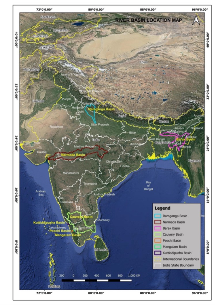
The project included River morphological studies and sediment morphology study for 3156 km of rivers. The project studied the basins of seven rivers – Barak, Ramganga, Narmada, Cauvery, Mangalam, Peechi, Kuttiadipuzha flowing across thirteen Indian states (Assam, Tripura, Meghalaya, Nagaland, Manipur, Mizoram, Uttarakhand, Uttar Pradesh, Madhya Pradesh, Gujarat, Karnataka, Tamil Nadu, Kerala) and having a cumulative catchment area of 265,000 km2.

Map of India showcasing all the river reaches covered as part of the project

About the Initiative

Integrated water resources management is crucial for addressing floods, droughts, and sediment management in river basins. This study established mathematical models of soil hydrology, overland flow, river discharges, sediment generation, transportation, and retention by hydraulic structures such as dams. The project prepared and disseminated hydraulic and sediment transport models, including 2D morphological models, for pre-emptive mitigation, continuous service delivery during flooding, and faster recovery. An integrated data-model platform was developed, including online and offline dashboards for data visualization, dissemination, and operational use. Training and workshops enhanced the institutional capacity of national and local authorities, reducing risk at the local and regional level.

Compilation of all information/data related to sediment generation, sediment transport, river morphology, and sediment deposition was conducted. The focus was on understanding the mechanisms of sediment generation and transport in catchments and rivers. A variety of models have been developed in this study, such as sub-basin sediment generation and transport models, river morphological models, dam operation models, slope erosion model, pilot reservoir sedimentation models.

Present conditions and critical areas/reach in the catchment were assessed, considering the factors contributing to sedimentation. Mathematical models were developed for each river basin, encompassing sediment generation, sediment transport, siltation/de-siltation of rivers, and erosion/deposition in riverbanks. The impact of land use and land cover changes was assessed to understand their influence on sedimentation. Sedimentation rates were estimated from various parts of the catchment, considering the rate of sediment movement in the rivers, morphological parameters of rivers, and sediment deposition profiles in flood detention structures for each river basin, with a confidence level assigned.

Critical and vulnerable locations were identified based on the collected data and analysis. Catchment treatment and river training works were implemented to restore the critical locations, ensuring the management of sedimentation and river morphology

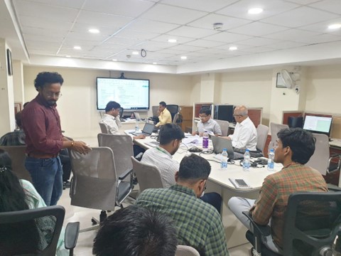
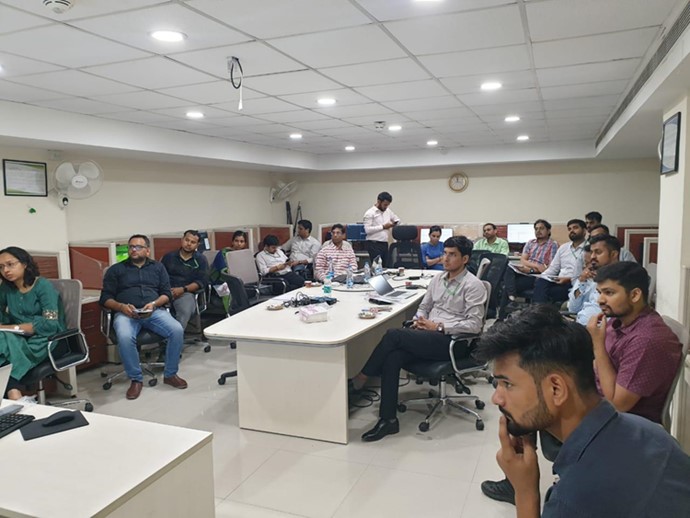
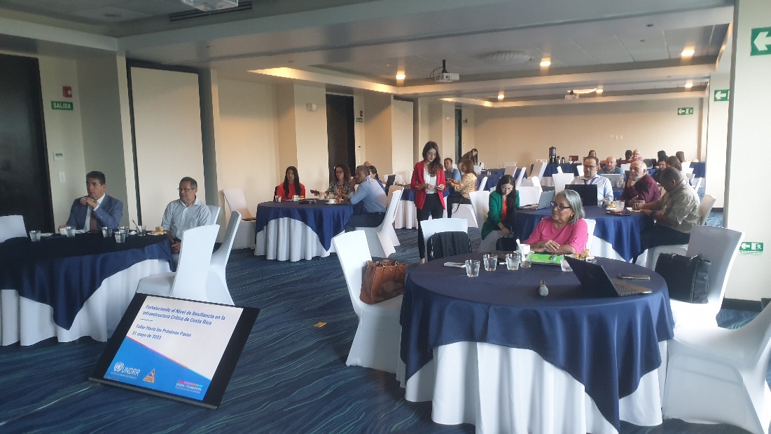
Capacity Building and knowledge sharing workshop at Central Water Commission Headquarters in Delhi

Learning & Impact

The project is to be completed in two phases in 30 months. Phase-1 concluded the development of the comprehensive models/ suite of models (18 months) and is currently ongoing, Phase-2 involves the operation, maintenance and updating of models/ suite of models (12 months). Data analyses revealed that in all these seven river basins more than 80% of the sediment flow happens during the monsoon season. Ramganga is the most dynamic river with meandering planform and migration among all other seven river systems. It is very dynamic with meander migration and formation of cut-off channels due to fragile banks. The rate of shifting of banks is as much as 2.5 km over 2 years in some locations. Next active river is Barak. However, its lateral changes are constrained by the natural ridges and flood embankments in the alluvial plain.

Both Cauvery and Narmada are morphologically not active as compared to Ramganga or Barak. Both are also affected by dams, reservoirs, barrages, and canals. Due to the small size, it is also difficult to analyze the morphological activities of these river systems using remote-sensing data (also because they do not show noticeable lateral shift). However, the data shows relatively noticeable sedimentation in Kuttiyadi reservoir (31% in 37 years), which implies that the upstream catchment generates some sediment (about 75% of which is silt and clay, and the rest is sand).

Many models have been developed in this study, namely the 7 main river basins and 63 sub-basin sediment generation and transport models, 7 river morphological models (1D), two dam operation models (1D with gate operation), one catchment slope erosion model, two pilot reservoir sedimentation models (2D). All the models are physics-based and include complex processes with high spatial resolution and temporal frequencies (unlike conceptual models). The project also summarizes the observed long term and modelled averaged sediment specific yield for all sub-basins. The models developed and the findings of this study can be used to prioritize areas for soil conservation measures, to locate a new structure or to plan any new developments, to prioritize operation and maintenance of dams and reservoirs, and to improve the monitoring of sediment load. Co-benefits include improvement in water quality, soil fertility and quality as well flood mitigation.

Co-Benefits of the Initiative:

In addition to sediment management, flood risk assessment and environmental Management, the project also has following co-benefits:

  • Ecosystem restoration and biodiversity conservation – The project identifies areas in need of ecosystem restoration and conservation, so that appropriate measures can be implemented to restore degraded habitats, promote biodiversity, and protect aquatic ecosystems.
  • Water resource management – The project is essential for effective water resource management. It helps in assessing water availability, sedimentation impacts on reservoirs, and the planning of sustainable water allocation strategies to contribute to efficient water management and ensuring a reliable supply for domestic and commercial sectors.
  • Scientific research and knowledge advancement – The project provides valuable data and insights that will be further used to improve understanding of river systems, sediment transport processes, and their interactions with the environment. This knowledge helps refine models, develop new theories, and enhance the overall scientific understanding of river dynamics.

Implementation Challenges and Mitigation Strategies:

  • The study was the first of its kind for India, and synchronization of existing data sets and methodologies with latest and best scientific practices was a challenge. For dissipating and sharing knowledge, several working sessions, workshops, and training were conducted with Central Water Commission and other stakeholders.
  • Given the nature and sensitivity of the study, a significant amount of the raw data provided by the client was classified. This meant entire teams had to be relocated to the client office. To optimize resources, the project accelerated the upgradation of client hard wares/systems and the capacity building of officials and engineers on client end to aid self-reliance as well as delivery of the project.
  • The study navigated through 63 sub-basins with limited availability of data for several sub basins. This involved heavy dependency and coordination with various national and local agencies. For smaller tributaries where flow data and sediment data were unavailable, models were built and calibrated from existing data and finally, the validated and proven model was applied to tributaries with missing data.
  • The quantification of erosion and sedimentation from satellite images was often hindered due to cloud cover. This was resolved via close attention to detail in selection of satellite data, particularly in durations when cloud coverage was less than 5%.

Scalability:

  • Non-availability of high spatial (10kmx10km) and temporal resolution (30 minutes) ground observed rainfall data for the entire basin is a constraint. The best available data was utilized but lack of high-quality data and related uncertainties may have compromised the efficiency and output of the model. Enhanced data input will result in more efficient model output. This has been reflected in some of the sub-basins or in some of the years though the IMD gridded daily rainfall data matched the sum of rainfall data. Another constraint has been the non-availability of more accurate land use and land cover map on density and forest/plant height. Despite the constraints, open LISEM model simulations provided the insights required to gain on the processes of sediment generation.
  • Within the scope of this part of the assignment, various innovative tools (e.g., for semi-automated and automated processing of satellite images), methods (e.g., for reservoir bathymetry reconstruction) and some demonstration pilot models (e.g., catchment slope erosion model, 2D reservoir models, 1D reservoir operation models) have been developed and applied. These tools, methods and model studies will be useful in future as well for various hydraulic and morphological modelling and analyses such as reservoir operation, meander migration and riverbank shifting, in-stream river erosion and sedimentation, reservoir sedimentationThey can also be adapted to other river systems and basins.
Capacity Building and knowledge sharing workshop at Central Water Commission Headquarters in Delhi

India

Implementing Agencies & Partners:
  • Central Water Commission, India
  • Department of Water Resources, India
  • River Development and Ganga Rejuvenation, India
  • Ministry of Jal Shakti, India
  • Royal HaskoningDHV
  • Secon
  • Deltares
  • University of Twente

Acknowledgement:

This case study has been contributed by Royal HaskoningDHV.

Disclaimer:

This Compendium of Good Practices on Disaster Resilient Infrastructure (DRI) has been compiled through content contributions from G20 member countries, invited countries and international organisations. The contents and views expressed in this website publication reflect the opinions of the contributing agencies and are not necessarily the official views of CDRI.