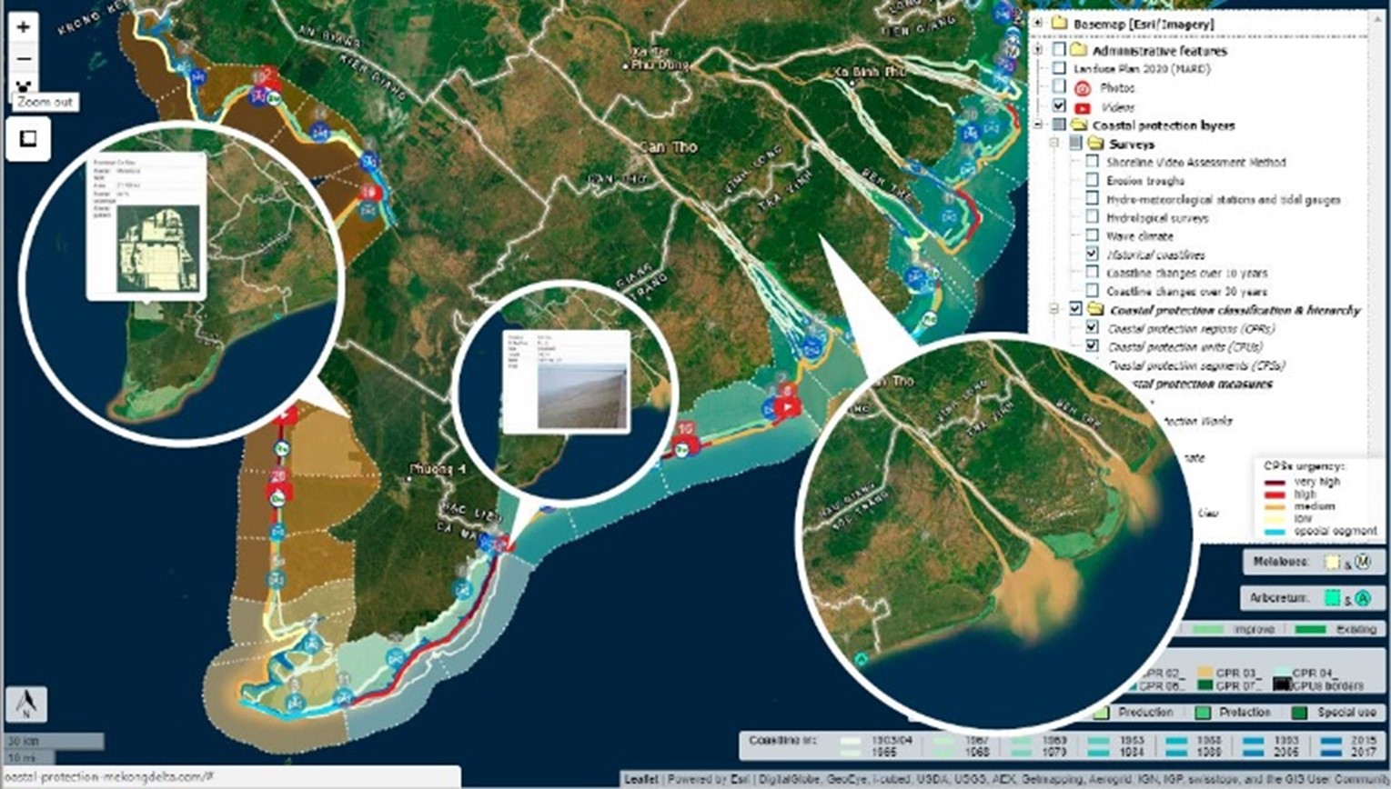
Due to climate change impacts and direct anthropogenic causes, the Mekong Delta with its key economic role, low elevation, and 17 million inhabitants, is faced with a multi-layered risk situation comprising the risk of storm surges, erosion, flooding, land subsidence, and saline water intrusion. To address these risks, the CPMD aimed to provide a baseline for decision-making to plan coastal protection measures along the coast of the Mekong Delta and adjacent hinterland.
The tool provides among others an innovative classification system of the coast, a compilation of downloadable datasets on design parameters for coastal waterworks and land-use, a critical evaluation of all existing protection measures in the Mekong Delta (Pros & Cons), historical changes of the coastline since 1904, recommended prioritization of coastal protection measures (and rough cost estimates), and the systematic inclusion of lightweight drones (Unmanned Aerial Vehicles – UVA’s) in coastal surveys. Data aggregated within the decision support tool is based on existing evidence provided by recent studies, fine-grained assessment by local experts and international consultants (from Germany, Australia, the Netherlands, and France) and the feedback of provincial government agencies under the mandate of MARD and VNDMA.
What is consequentially needed for the Mekong Delta is a strong interlinked system of mangrove protection forest, breakwater, sea dyke and proper land-use and water management in the hinterland. Concrete recommendations on feasible waterworks and mangrove rehabilitation for the entire 720 km of shoreline is provided. The most effective coastal protection systems consist of different elements arranged one after the other from breakwater to mangroves to a sound dyke. The cost estimates for direct investments in structural measures are in the order of about 1.4 billion USD for the coming 10-15 years (2018-2030).


