Introduction

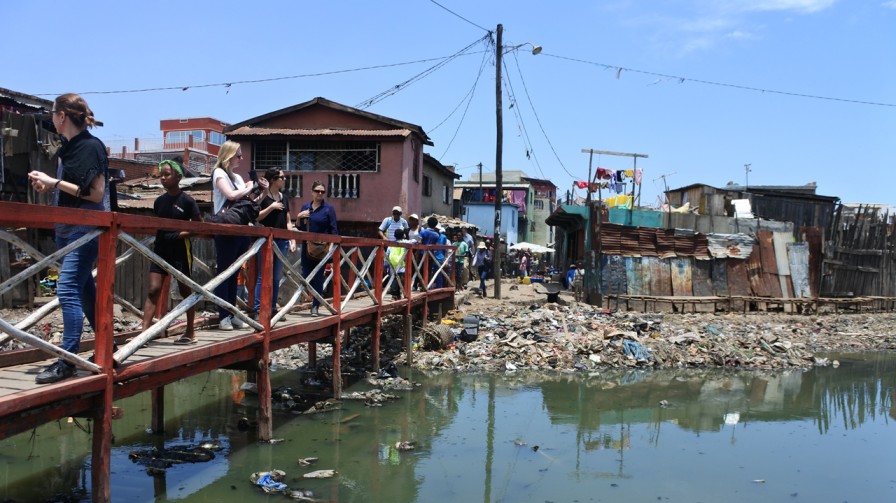
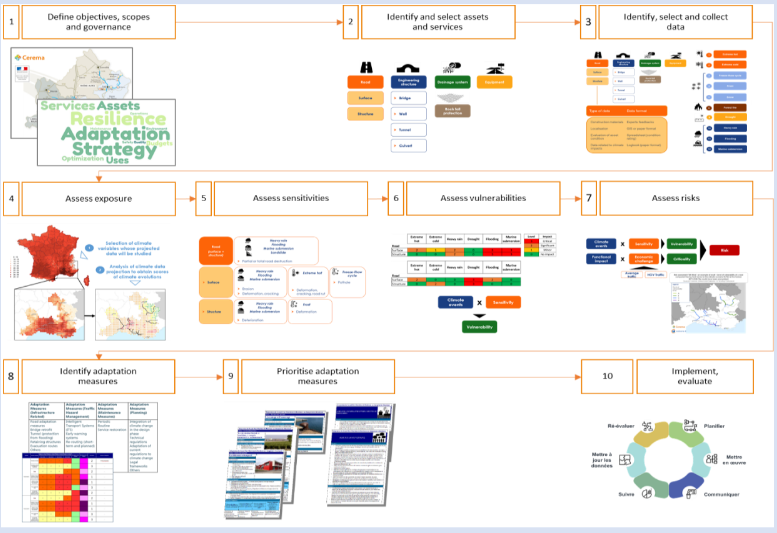
This work proposes a 10-step methodology for building a resilience strategy for transport infrastructure in the presence of climate-related hazards. In the context of climate change, this work provides a framework for assessing the interface of climate risks and transport infrastructure through an analytical framework that focuses on vulnerabilities and criticalities of transport infrastructure to current and future climate scenarios. Further to the risk analysis, the methodology helps in the identification of adaptation measures and prioritises those to implement an effective adaptation strategy.

Main steps of the methodology to build a resilience strategy

About the Initiative

The method of building a resilience strategy requires defining its objectives, scope, and governance of the approach. By developing an adaptation strategy, road authorities, asset and network owners can pursue various objectives related to optimising their budgets and investments. This would, in turn, help in network maintenance, ensuring a certain level of service provisioning.

The objectives setting phase guide the overall scope of the analysis, categorised within the following identifiers:

  • The climatic scope, i.e., the hazards to be assessed; the horizon(s) and scenario(s) of projection,
  • The physical scope, which corresponds to the different infrastructures to be assessed,
  • The functional scope, which is the list of services or functionalities (commuting, goods transport, etc.) provided by a network,
  • The geographical scope, which depends on the three previously mentioned scopes.

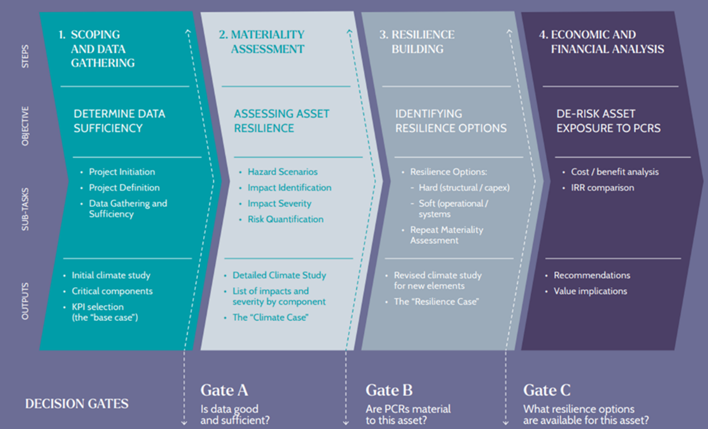
The following are the key steps involved in building a resilient strategy for transport infrastructure:

  • Facilitating vulnerability assessment by carefully choosing and categorising the transport assets.
  • Identifying and gathering asset data, data related to their functionalities, and climatic data (past, present, and projected). This step is highly dependent on the defined scopes.
  • Analyzing the climate projections based on long-term hazard data, such as its severity or frequency.
  • Rating the infrastructure sensitivity to hazards. The sensitivity rate may increase depending on the inherent characteristics of infrastructure, such as its age, its level of maintenance, its construction material, and the standards used for its design or construction.
  • Assessing the physical vulnerability of networks, systems and components by cross-examining the sensitivity of the infrastructure due to its exposure to climate hazards.
  • Defining and rating the functional vulnerability of the network due to hazards, which corresponds to the level of impact on their functionalities such as a disaster-affected road, would be inoperable for one or more hour(s), ultimately leading to traffic slowdown.
  • Assessing risks requires defining the services provided by a transport network to a territory or the territory's expectations from the network. The risk analysis consists of identifying the impact of climate hazards on these services or expectations. This step is different from the functional vulnerability assessment, which does not consider the issues related to serving the territory.
  • Identifying adaptation measures for assets at risk. Adaptation options may relate to the exposure of assets, their sensitivity, vulnerabilities or risk. Various adaptation solutions exist related to the design, construction, maintenance, exploitation, and planning of infrastructures leading to hazard mitigation.
  • Defining a resilience strategy by prioritising the previously identified adaptation options. This is aligned to meet the objectives defined in the first step, and it will generally include recommendations on the adaptation measures to be adopted. It is designed to be embedded in the relevant decision-making processes.
  • Implementing the resilience strategy and creating mechanisms for its regular monitoring.

Learning & Impact

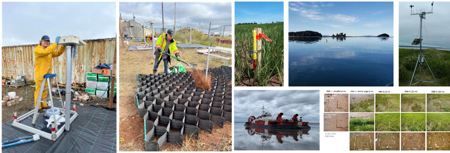
This method has been applied, fully or partially, in France to many transport infrastructures, notably the rail networks (SNCF Réseau: Axe Seine, new LGV-line Montpellier-Perpignan, Bordeaux-Toulouse axis of the Grand Projet du Sud-Ouest, which is a new LGV-line, Occitan network; LGV SudEurope Atlantique for the operator Lisea), road networks (Nièvre department, a section on Highway 9 for the operator ASF, the network operated by Sanef/SAPN) and ports (Grand Port Maritime de Bordeaux, Port Atlantique de La Rochelle, Grand Port Maritime de la Martinique).

  • A vulnerability study is currently planned for 2023-2024 on the 21,000 km of the French national road network (including the concessionary motorway network).
  • This method is also currently being applied in a large multi-modal risk assessment of the transport infrastructure of the Sud-PACA region.

France

Implementing Agencies & Partners:
  • Ministry for the Ecological Transition, France
  • CEREMA (Centre for Studies on Risks, the Environment, Mobility and Urban Planning), France

Acknowledgement:

This case study has been contributed by  Ministry for the Ecological Transition, Government of France.

Disclaimer:

This Compendium of Good Practices on Disaster Resilient Infrastructure (DRI) has been compiled through content contributions from G20 member countries, invited countries and international organisations. The contents and views expressed in this website publication reflect the opinions of the contributing agencies and are not necessarily the official views of CDRI.