




 |
On an ordinary morning in 2024, a technician from the Dominican Republic's Water Resources Institute (INDRHI) walked through the doors of the Emergency Operations Centre (COE) in Santo Domingo carrying a hard drive. The data on that drive had had been preserved for years by an institution that understood its value. What was new was the decision to transport it across the city and hand it over. That decision, repeated by one institution after another over a period of two years, is the real story of this project. |
|
|
|
A country that knew it was vulnerable, but uncertain of the full extent
The Dominican Republic has never been in doubt about its exposure. Hurricanes, floods, landslides, earthquakes, tsunamis, wildfires and dengue occur, sometimes within a single season, and at the same time. Roughly half the population (approx. 6 million people) lives in two metropolitan areas, Greater Santo Domingo and Santiago de los Caballeros, which also hold most of the country’s critical infrastructure. What the country lacked was not the awareness of risk. It was a shared vision, language precise enough to act on, and a way to visualize both.
Each institution held a piece of the picture. The Dominican Institute of Meteorology (INDOMET) tracked storms, the National Geological Service (SGN) monitored seismic activity, and the INDRHI measured river levels. Their pieces existed in different formats and systems, behind separate institutional walls. When a hurricane made landfall, the COE coordinated the response not from comprehensive situational awareness, but relying on a patchwork of phone calls and ad hoc reports. The people running those institutions were not unaware of the problem. They had attended the same workshops for years, only to return to office facing the same barriers. Among them a quiet institutional logic that treated data as an asset to be protected rather than a resource whose value grew through sharing.
What changed
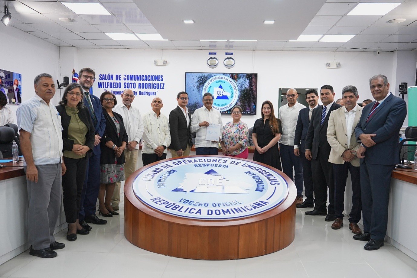
What changed was not the argument, which had been made many times before, but the demonstration that sharing had a concrete, immediate and institutional payoff. An agency that contributed its monitoring data received, in return, a multi-hazard risk profile of every asset it managed, calibrated against decades of historical impacts and overlaid with population vulnerability. It got back more than it gave. That reciprocity was the mechanism behind almost everything else the project achieved, and probably the most transferable thing it produced.
A map that can see who, not only where
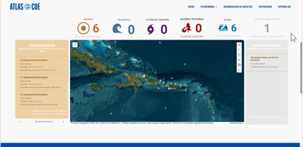
The Risk and Vulnerability towards Emergencies Atlas (RVEA) went live in December 2025. It is the country's first platform for centralized multi-hazard risk analysis, built on a methodology developed through detailed discussions with Dominican institutions, indicator by indicator.. It indexes eight infrastructure sectors, against an original target of three. Once agencies understood what the Atlas could offer in return, they asked to be included and contributed their own data. The platform is anchored by a registry of more than 1,330 historical disaster events, aligned with Sendai Framework reporting.
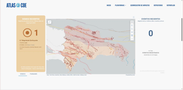
In practice, it can tell a dam operator how exposed their facility is to flooding or help the health ministry decide which hospitals to reinforce before the hurricane season.
It can also do something less common. The methodology disaggregates exposure and vulnerability by sex, age, disability status and economic condition, incorporating social vulnerability indices alongside the physical risk indicators. The reasoning was straightforward: a risk atlas that cannot identify who is most vulnerable within a community cannot fully protect everyone in it. Building these considerations into the methodology from the outset proved far easier than retrofitting them later.
The alert that nobody owned
A technical assessment of Alerta-COE app, the government's public alert application, found that its source code was controlled by a single external developer, with no contract in place and no documentation shared with the government. The channel through which the state warns millions rested on one person's availability.
The application could have been patched. Instead, it was rebuilt, with a new back end, front end and control panel, documented and owned outright by the Dominican state. The new system integrates the Common Alerting Protocol and can deliver warnings as geographic polygons, ensuring that a flood alert reaches the affected basin rather than the entire country. This approach required a broader scope and more time than a patch, but it left the government with a system it could maintain, manage and build on.
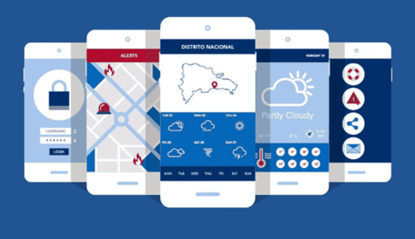
The project also integrated a directory of 77 senior liaisons from 43 infrastructure institutions into the alert system, along with a catalogue of messages tailored to their needs. What a water treatment plant manager needs to know twelve hours before a hurricane is not the same as what the public needs to know. Infrastructure operators, historically on the receiving end of emergencies, are now active participants in the alert system.
What is working now, and what is still emerging
This CDRI-IRAF funded project closed in March 2026, and the distinction matters.
Achieved and verifiable at closure: the Atlas was made live; the first formal trilateral agreement in the history of Dominican disaster risk management (between COE, CNCCMC, and MINPRE) remains in force; 41 institutions have now joined the coordination structures against a target of 16; 307 officials have been trained against a target of 180, including 116 women; and a maintenance team from three institutions expanded the platform without external support.
Still emerging and reported honestly as such: the establishment of a permanent geomatics unit funded through the national budget remains a discussion, rather than a secured budget line. A collaboration agreement with the telecom regulator and private operators, the scaffolding for a future cell broadcast system, has been drafted but not signed; binding private operators to public emergency obligations is a multi-year process. No financing for infrastructure resilience has been formally mobilized; the contribution was catalytic rather than direct. And the progress in disaggregating vulnerability has not yet matched by accessible alert formats for people with sensory or mobility disabilities: the system can identify who is the most vulnerable but does not yet communicate differently.
Perhaps the most compelling evidence of institutional adoption is behavioural. The National Statistics Office (ONE) deployed its own staff to COE through the end of 2025, without project funding. The National Geographic Institute (ING) took responsibility for validating of the Atlas's geographic layers as an institutional commitment. These are not actions of institutions simply fulfilling a donor obligation.
What might travel
Anchor the work in the institution with the greatest convening authority (COE), before designing any technical content. Coordination built without such an anchor tends to exist on paper, not in practice.
Build something early and show each institution what its own data can bring in return. Arguments for data sharing rarely move institutions. Seeing their contribution come back enriched does.
Check who owns the code behind your national alert channel, and whether a contract exists. It is an uncomfortable question, but one that takes an afternoon to answer. In our case, the answer changed the course of the project.
The Atlas is live. The agreement holds. The 307 people trained will carry what they learned into every emergency the country faces next.
But what may endure longest is harder to capture in a results framework: the understanding, now demonstrated rather than argued, that an institution sharing its data does not give something away. It gets something back - a fuller picture of the risks it is responsible for managing, enriched by the contributions of every other institution that made the same choice.
The hard drive carried through those doors on an ordinary morning in 2024 held more than data. It marked the beginning of a common language.
By
Carlos Matías Figueroa, Climate Action Senior Officer, Global Green Growth Institute (GGGI)
The Dominican Republic National Multi-Threat Early Warning System project was implemented by the Global Green Growth Institute (GGGI) between April 2024 and March 2026, in partnership with the Centro de Operaciones de Emergencias (COE), the Consejo Nacional para el Cambio Climático y el Mercado de Carbono (CNCCMC)and the Ministerio de la Presidencia (MINPRE). We extend our gratitude to the Governments of India, Australia and the United Kingdom, and to the European Union, for their financial support for this project through the Coalition for Disaster Resilient Infrastructure’s (CDRI) Infrastructure Resilience Accelerator Fund (IRAF) under the Infrastructure for Resilient Island States (IRIS) programme.
